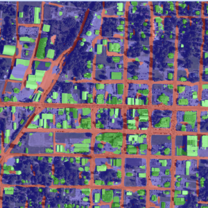
Timely reliable damage assessment of buildings and infrastructure in the wake of natural disasters is crucial for organized response and recovery efforts. To aid this effort, this project leverages modern machine learning and AI techniques to rapidly analyze the before and after satellite images of affected areas to assess damage.
In partnership with Red Cross Netherlands, our goal is to build a robust tool that is adaptable to detecting buildings and inflicted damage across the globe. Using satellite images and computer vision is a major improvement on previous ways of gathering information about damage in a region from media reporting and communication networks, which can be unreliable, have coverage gaps, or be interrupted during disasters.
The work from our data scientists within the Data Core and Data Science for the Common Good programs will help the Red Cross make critical decisions about recovery efforts and provide aid to those affected.